When it comes to infrastructure projects, choosing the best road design software can mean the difference between hours of manual work and a smooth, efficient workflow.
Today’s engineers and designers need tools that not only model roads accurately but also integrate with broader civil engineering processes.
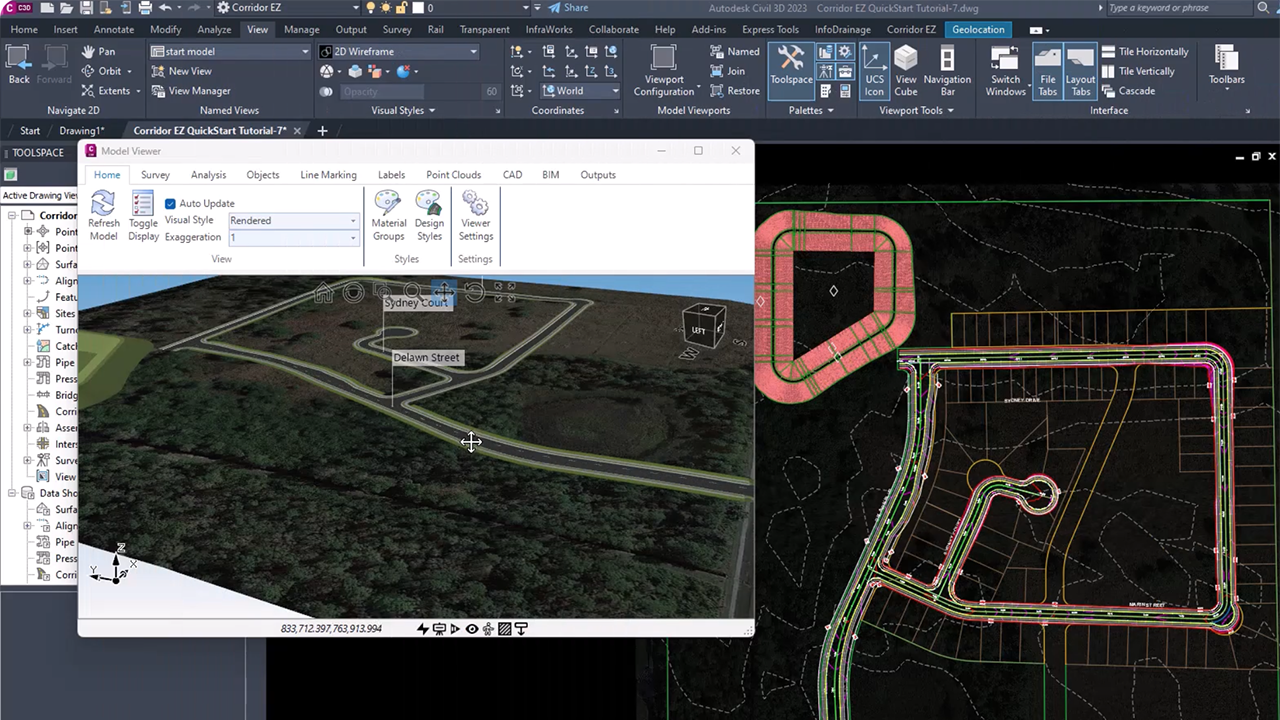
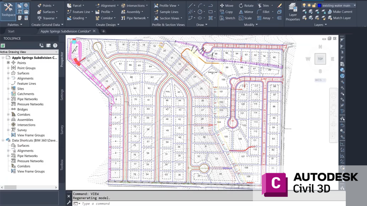
At the top of the list is Autodesk Civil 3D, widely considered the industry standard. Civil 3D provides advanced corridor modeling, grading, and surface design capabilities. Its integration with AutoCAD makes it a versatile platform for transportation projects of all sizes.
Another strong contender is Bentley OpenRoads Designer, which offers comprehensive roadway design, earthwork analysis, and visualization features. With strong interoperability and support for BIM workflows, OpenRoads is often chosen for large-scale infrastructure projects.

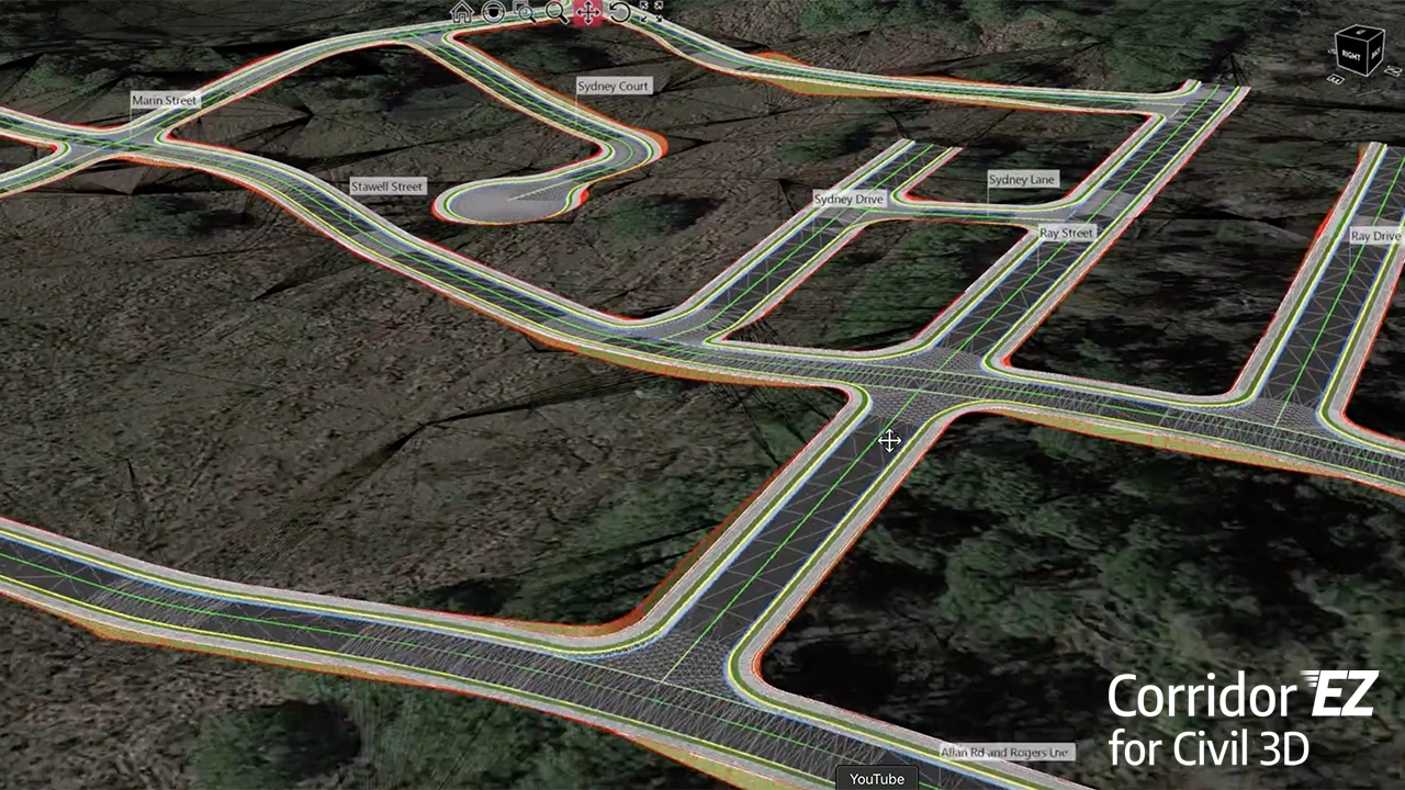
For firms seeking automation, Corridor EZ has emerged as a powerful add-on to Civil 3D. Corridor EZ streamlines corridor creation by automating baseline setup, target mapping, and assembly generation—cutting design time dramatically. For subdivision roads and complex intersections, it ensures consistency and reduces repetitive work.
InfraWorks from Autodesk is also valuable for early-stage conceptual design and visualization. It allows engineers to quickly evaluate multiple roadway options and present realistic 3D renderings for stakeholder approval.
Other specialized tools, such as MX Road and Trimble’s Quantm, support alignment optimization and cost-effective corridor planning.
Ultimately, the best road design software depends on project type, firm size, and required deliverables. Civil 3D remains the go-to platform for most engineers, but pairing it with automation tools like Corridor EZ or visualization platforms like InfraWorks can deliver the greatest efficiency and accuracy.
For engineering firms, the winning approach is often a combination—leveraging the strengths of multiple tools to deliver better designs, faster.
Comparison of the Best Road Design Software
|
Software |
Key Features |
Strengths |
Best Use Cases |
|---|---|---|---|
|
Autodesk Civil 3D |
Corridor modeling, grading, alignments, surfaces, AutoCAD integration |
Industry standard, powerful design tools, strong documentation workflows |
General road design, subdivisions, highways, DOT projects |
|
Bentley OpenRoads |
BIM integration, earthworks, advanced geometry, interoperability |
Excellent for large infrastructure, strong 3D modeling & analysis |
Highways, interchanges, large-scale transportation projects |
|
Corridor EZ for Civil 3D |
Automated corridor creation, baseline setup, target mapping, assembly reuse |
Saves hours of work, eliminates repetitive tasks, easy to learn |
Subdivisions, multi-road projects, quick corridor modeling |
|
Autodesk InfraWorks |
Conceptual design, visualization, rapid scenario modeling, stakeholder visuals |
Fast option testing, strong 3D visuals, integrates with Civil 3D |
Early-stage planning, public presentations, approvals |
|
MX Road |
Alignment optimization, terrain analysis, superelevation, design automation |
Long-standing Bentley tool, accurate geometric design |
Road alignment and terrain-driven roadway projects |
|
Trimble Quantm |
Alignment optimization, cost modeling, route feasibility studies |
Optimizes design for cost and environment, powerful early-stage analysis |
Route planning, large linear projects, cost-sensitive roads |
Summary
The best road design software depends on your workflow and project scale. Civil 3D remains the go-to for most engineers, but adding tools like Corridor EZ for automation or InfraWorks for visualization can create a powerful, efficient toolkit.
For large-scale infrastructure, Bentley OpenRoads and Trimble Quantm bring advanced capabilities. In practice, the winning strategy is often combining platforms—leveraging the strengths of each to deliver faster, more accurate, and more cost-effective road designs.